Tides and Floods

The lower Schuylkill River is tidal, rising and falling about six feet every day. These tidal waters come from the Delaware Bay some 70 miles downriver. Large areas along the river in South and Southwest Philadelphia originally consisted of marshy beaches, which naturally developed to handle the ebb and flow of these tidal waters (as pictured in the above image from 1858). These expansive beaches also gave storm water plenty of room to spread out. And, the plants and soil found in these areas were well suited to handle periodic flooding. You can still see an example of this type of riverbank along the Bartram’s Mile trail near the 56th Street Plaza (pictured below).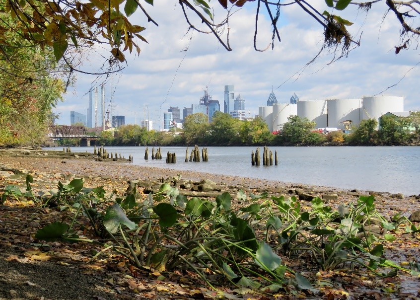 Marshy beach along Bartram’s Mile in Southwest Philadelphia. Photo taken in 2016.
Over the centuries, dams, wharves, bulkheads, and land infill changed the shape of the Schuylkill riverbank. Along the Center City portion, the river’s steep and narrow sides leave less room for tide and rain water to spread out and gradually get absorbed into the ground. This can lead to dramatic flooding conditions, with high water levels infiltrating the city. In March 1902, the City recorded its most severe flood, which crested at 14.8 feet – that is over eight feet higher than the normal high tide crest. That high water line translated to flooding the Baltimore & Ohio Railroad Station then located at 24th and Chestnut. The most recent major flood along the lower Schuylkill occurred on May 1, 2014, when the city recorded water cresting at 13.9 feet (pictured below). Read more about the history of flooding along the lower Schuylkill here. 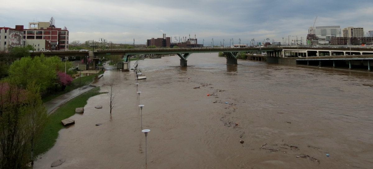 May 1, 2014 flooding along Schuylkill Banks looking south from the Chestnut Street Bridge.
Schuylkill Banks plays an important role in helping to manage the tidal river and the City’s stormwater. The trees, shrubs, and meadows planted along the greenway absorb rain water, helping to regulate the amount that reaches the river on a regular basis, and the park space creates a buffer to protect homes and businesses along the river from flooding during periods of heavy rainfall or snow melt. The City, understanding the need for a flood buffer, passed an ordinance in 2012 requiring all new waterfront development to provide a 50-foot buffer along all rivers and streams. This ordinance not only keeps industry and development away from riverbanks and potential future damage caused by flooding, it also protects the quality of our drinking water source and creates a space for future recreational trails. Read more about the ways Schuylkill Banks and the City are improving stormwater management and creating a more flood resilient city here.


