How We Got Here

In 1992, a group of Fitler Square neighbors formed the Schuylkill River Development Council (SRDC) to advocate and raise funds for a riverfront park. Thanks in large part to its advocacy, the City of Philadelphia Department of Streets cleared, bulkheaded, and added a paved trail along the riverfront between Locust Street and MLK Jr. Drive, with the trail officially opening to the public in 2000.
SRDC formed three decades ago to build what is now known as Schuylkill Banks, but tenacious advocacy for a green riverfront goes back to the 1920s when John Frederick Lewis presented his “The Redemption of the Lower Schuylkill” address to the Mayor of Philadelphia. Lewis described in vivid detail the pre-industrial character of the Schuylkill River, how the rush towards industrialization without concern altered the river and its banks, and his thoughtful plan to restore the river from its industrial scars by turning the east and west riverbanks into driveways that “could be appropriately planted with trees and made splendid avenues for the traffic of all the east and west streets upon both sides of the River. Trees would grow with vigor… and then, in course of time, the peninsulas formed by the windings of the river, could be turned into public parks and playgrounds for the vast population now living in the Schuylkill wards, and which will become more vast as available building sites were created in consequence of such improvement.” Read Lewis’s full address here.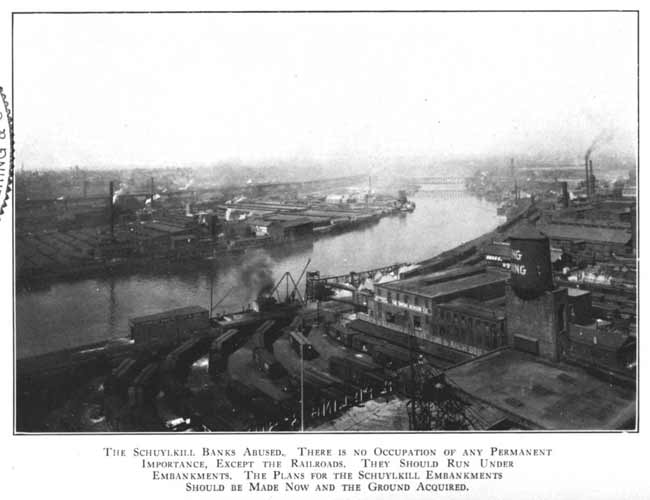 Image of the industrial riverfront provided by PhillyH2O
Lewis’s poignant address did not spark immediate change and industry persisted along the river. However, the idea of a green riverfront was not entirely abandoned, and in the mid-1960s, the Fairmount Park Commission developed the Schuylkill River Park Master Plan. The plan noted that the “Schuylkill River Park will make the riverfront an integral part of the city, providing a direct link between Center City and the existing Fairmount Park. Facilities will be provided for boating, hiking, cycling and active sports for all ages. … and the development of a continuous green edge will leave a lasting impression, enhancing the image of the entire city.” Read the 1967 Master Plan here, which presents ideas about realigning the railroad and creating stormwater storage under the trail to help with Philadelphia’s combined sewer overflow system (wow!). 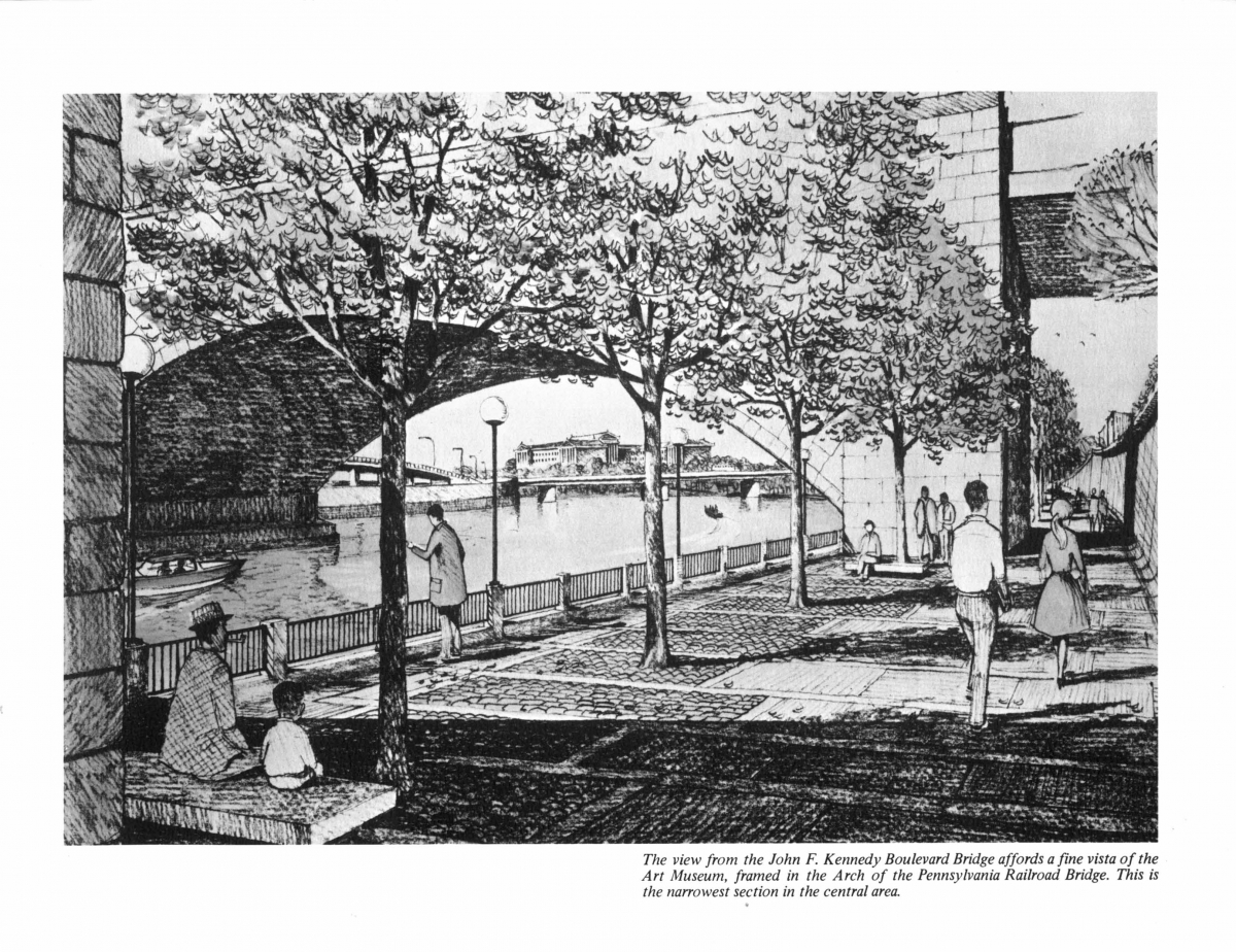 Rendering of the proposed riverfront trail from Schuylkill River Park Master Plan
In 1979, the first phase of the Master Plan was completed and the six-acre Schuylkill River Park between Spruce and Lombard Streets and east of the railroad tracks opened to the public. One year after the park opening, the City released a progress report titled “Schuylkill Park: A New Riverfront Park For Philadelphia” stating the 1967 “Master Plan underwent significant revisions. The park setting became less formal, thus less costly; naturalistic planting replaced the formal groves of trees. The promenade deck over the railroad was eliminated, and the granite facing on the bulkhead was replaced with textured concrete. In fact, the decision was made to reuse existing bulkheads wherever possible." The progress report also noted that “The overall character of Schuylkill Park will be informal and ‘woodsy,’ in contrast to the formality developed at the Penn’s Landing waterfront. This is fitting, as the Schuylkill has a smaller-scale, passive nature, in contrast to the port activity and great width of the Delaware.” Read the full 1980 progress report here. 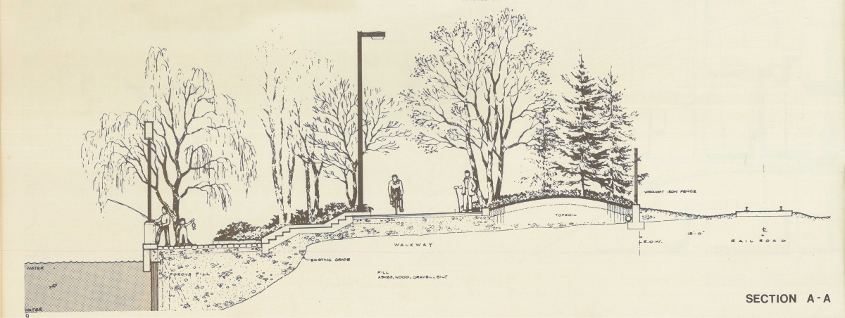 Rendering of the proposed riverfront trail from Schuylkill Park: A New Riverfront Park For Philadelphia
At last, it was the 1990s that proved to be the moment for greening the riverfront as described in an editorial included in the Philadelphia Inquirer. “On the drawing boards for decades, Schuylkill Park is set to move ahead now, thanks to … a citizen-led group of boosters. They have proven … that major projects can get done in this city.” (Philadelphia Inquirer, Editorial Page, June 8, 1995). That citizen-led group, known as Schuylkill River Development Council and later renamed Schuylkill River Development Corporation, secured funding to update the Schuylkill River Park Master Plan and raised additional funding to construct the bulkhead and carve out a 1.3-mile park along the riverfront. 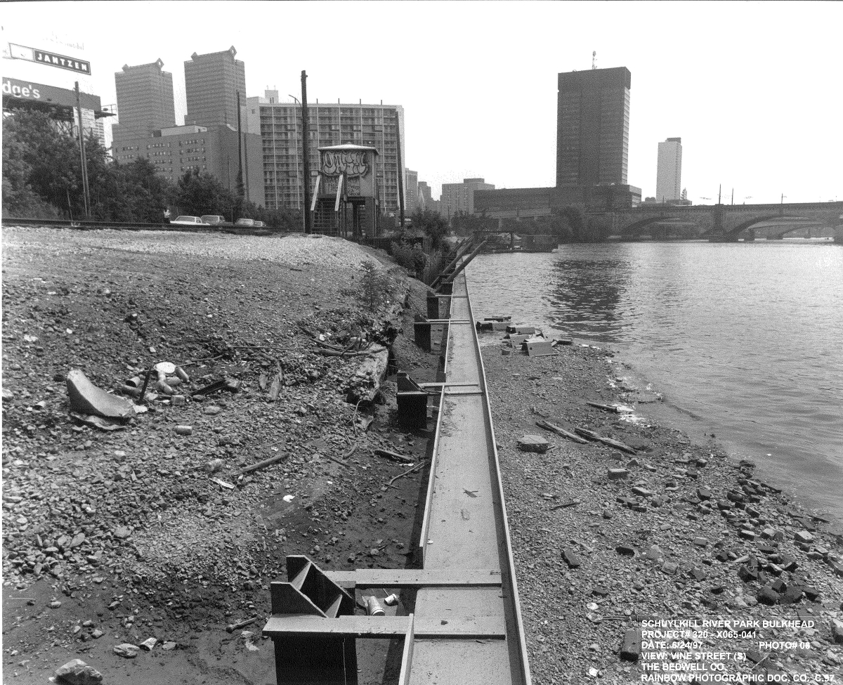 Image of a portion of the Center City bulkhead being built in 1997
By 2000, SRDC had accomplished a majority of its initial goal and began to shift its focus from building a riverfront park in Center City to building an eight-mile riverfront trail from the Fairmount Dam to the Delaware River. This shift to focus on the entire tidal river was, according to SRDC’s founder John Randolph “... an extraordinary opportunity for SRDC, as it represents the fulfillment of an important goal: the creation of a sustainable public private partnership that will plan and implement long term positive change on the tidal river.” The public-private partnership that is embedded in SRDC’s early development and continues today is the main reason it has been able to plan, design, build, maintain, and program Schuylkill Banks and cannot be understated. Read highlights from SRDC’s first ten years in its progress report “Reclaiming the Tidal Schuylkill River: 1992-2002.” 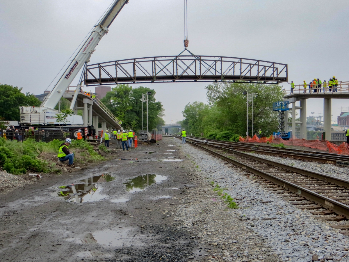 Image of the Schuylkill River Parks Connector Bridge being installed in 2012
To guide its new focus, SRDC worked with community members, organizations, businesses, and public agencies to create the “Tidal Schuylkill River Master Plan: Creating a New Vision” which continues to lead the long-term, positive and sustainable change along the riverfront. Read a summary of the 2003 Master Plan here. With the new plan in place, SRDC and the City began planning, designing, and building the trail and greenway south of Locust Street as land and funding became available; the Grays Ferry Crescent and Schuylkill River Parks Connector Bridge opened in 2012, the Boardwalk opened in 2014, Bartram’s Mile opened in 2017, South to Christian opened in 2018, and Bartram’s to Passyunk Phase I opened in 2021. 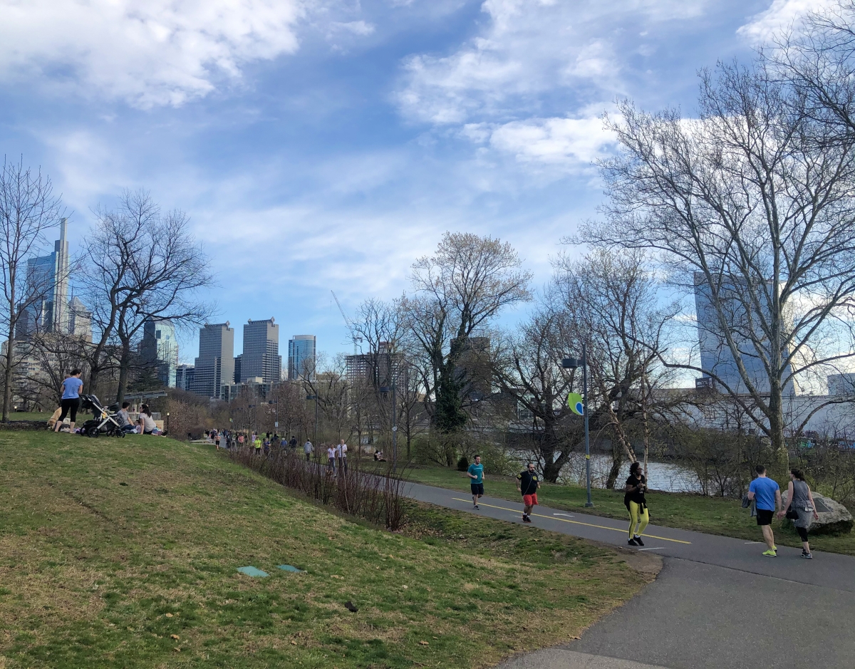 Image of the northern end of Schuylkill Banks, which used to be occupied by coal yards and factories up to the river's edge.
SRDC and the City’s shift in focus from a riverfront park ending at Locust Street to encompass the entire tidal Schuylkill River corridor and the communities living and working along its banks highlights the importance of the river corridor to the health and well-being of its residents. Building the eight-mile riverfront trail turns industrial land and brownfields into vibrant public park land that provides people of all ages and backgrounds a place to recreate, exercise, unwind from life’s stresses, celebrate special events, and come together with family and friends. It provides a safe and low- or no-cost transportation route for people to get to jobs, schools, health services, and other resources. It encourages community and economic development opportunities that promote long-term job growth. It provides a connection to cultural and historical resources along the riverfront that promotes tourism. It provides vital habitat for urban and migrating wildlife. And, it cleans the air, filters pollutants from stormwater before entering the river and Philadelphia’s drinking water source, and helps mitigate flooding.
SRDC is truly grateful for the countless people who have helped make Schuylkill Banks everything that it is today. As we celebrate the last 30 years of riverfront revitalization rooted in 100 years of advocacy, we look forward to another 30 years and more of revitalization.


